
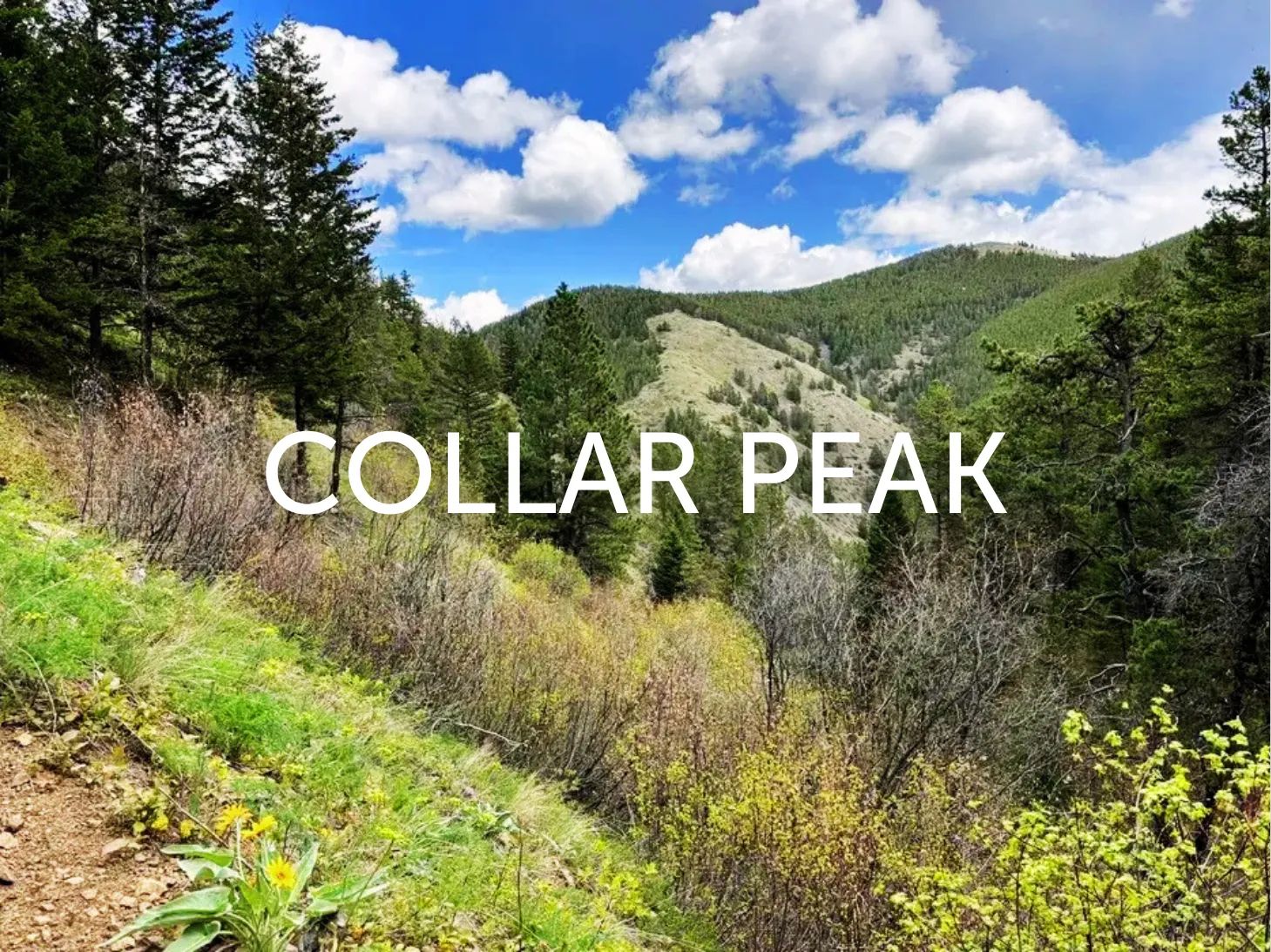
Collar Peak
Collar Peak is a beautiful hike located in the Judith Mountains northeast of Lewistown, Montana. Maintained by the Bureau of Land Management (BLM), this trail offers a rewarding mix of forested sections, open meadows, rocky outcrops, and sweeping panoramic views across Central Montana’s plains. On clear days, views can stretch for 50+ miles.
Updated 2026 Trail Information
Collar Peak Trail is a moderate day hike with a variety of terrain and excellent scenery.
Amenities
- None (primitive trailhead with limited parking)
Hiking
Hiking
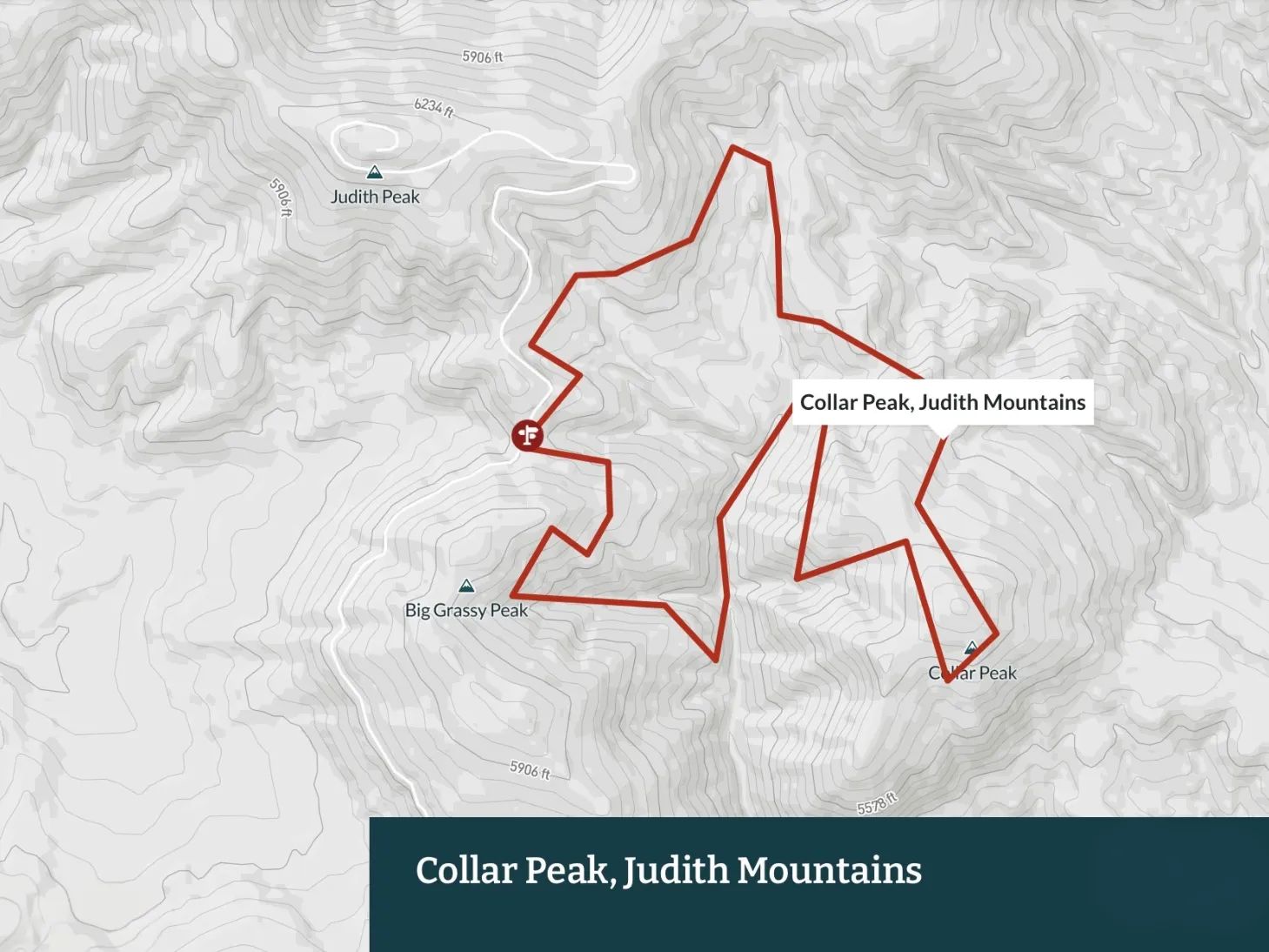
Collar Peak Trail / Collar Peak Loop
A scenic hike through lodgepole pine and fir forests leading to open summit meadows. Popular as either an out-and-back or loop route.
Length: 5.0 – 5.5 miles (loop or out-and-back)
Elevation Gain: 1,100 – 1,300 ft
High Point: ~6,129 ft
Difficulty: Easy to Moderate (some steeper sections near the summit)
Notes:
- Girl Scout Camp Trail branches south toward Collar Gulch Creek.
- Trail conditions can change after storms (possible downed timber or washouts).
- No water available on the trail — bring plenty.
Big Grassy Peak and Collar Peak
A lightly trafficked out-and-back option that offers good wildlife viewing opportunities.
Length: ~5.5 miles out-and-back
Elevation Gain: ~1,500 ft
Difficulty: Moderate
More Information on This Trail:
Biking
Collar Peak offers fun mountain singletrack with a mix of climbing and rewarding downhills. Good variety and scenic views.
More Information on This Trail:
How to Get There
Collar Peak Trailhead is approximately 20 miles from Lewistown.
Take US Highway 191 north from Lewistown for about 10 miles, then turn right onto Maiden Gulch Road. Continue approximately 13–14 miles toward Judith Peak. The trailhead will be on the right side of the road — look for the BLM sign.