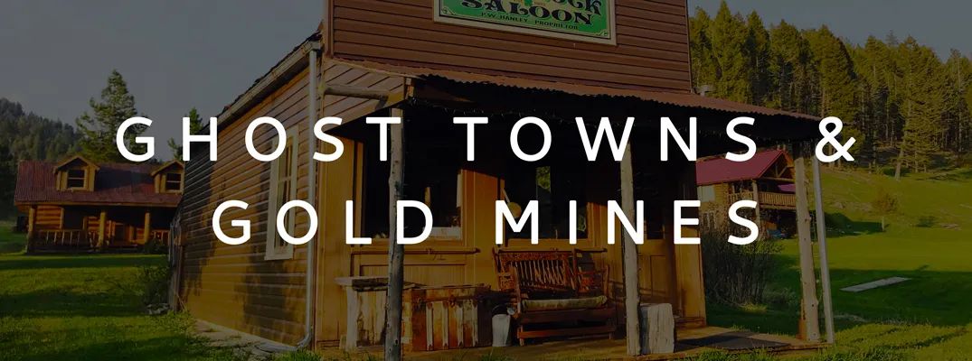
Ghost Towns and Gold Mines
The information below is taken from the Ghost Towns and Gold Mines Brochure. You can download it here.
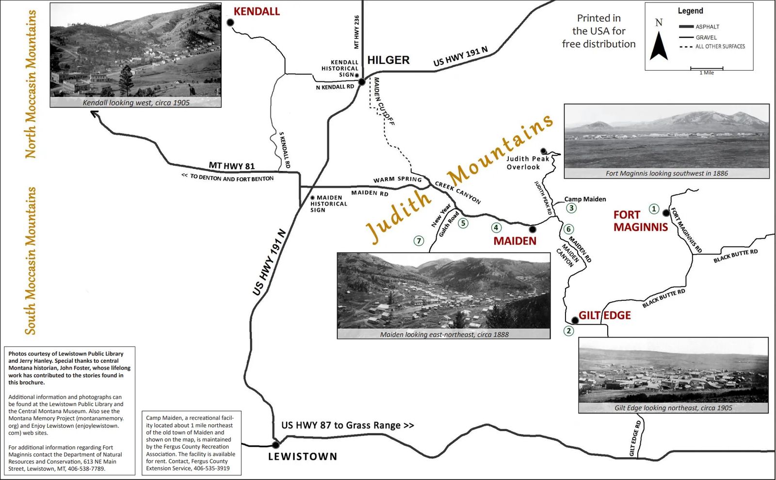
FORT MAGINNIS
By Sam Phillips and Jerry Hanley, 2017
Following the demise of Custer’s Seventh Cavalry in June of 1876 and the Nez Perce campaign through much of Montana in 1877, pressure was brought to bear on Montana’s Territorial delegate Martin Maginnis to provide military forts to protect the growing influx of settlers including ranchers, miners, and merchants. Longtime associates of Maginnis were persuasive in convincing their old friend of the need for a fort in central Montana which would, incidentally, contribute to their personal business gains. The fort was established in 1880.
One hundred ninety four skilled craftsmen from the east were hired by government contract to construct the fort near the eastern side of the Judith Mountains. Civilian contractors began their work in July of 1881, completing the task by November of 1881. The presence of Fort Maginnis provided a number of advantages to the areas adjacent to the military reservation. Besides the obvious purpose of protecting the settlers from Indians, there were the economic benefits, healthcare and the social life that the men of the fort enjoyed with their new neighbors.
Theatrical presentations, orchestral music, regularly held dances, and similar gatherings were popular with men and women from the nearby mining town of Maiden and ranches in the area. By 1886 some 266 enlisted men and officers served at Fort Maginnis. Some accounts indicate as many as five hundred people occupied the fort.
Fort Maginnis was a grand design of enlisted men’s quarters, a commissary store, a bakery, guardhouse, clerk office, a chapel, a school, blacksmith shop, hospital, and a number of other buildings. The post store was especially popular with both the military and the civilian communities. The telegraph was in use as well, enabling law officers in gaining an advantage on the criminal element.
After ten years of active service, Fort Maginnis was abandoned on July 10, 1890. The mere presence of Fort Maginnis seemed to provide much of its intended purpose as a ready protector to those in the frontier environs of Montana.
Most of the buildings were eventually moved or salvaged from the site. At least two buildings stand in Lewistown today and many others were used for building the town of Gilt Edge (1893).
Little can be seen at the site unless one walks it for a closer look at the numerous building foundations. The Fort Maginnis Cemetery (the famous cowboy E. C. (Teddy Blue) Abbott is buried here) is located on a hill about four tenths of a mile west of the site. The entire site is managed by the Montana Department of Natural Resources and Conservation through the Lewistown office.
MAIDEN
Ghost and Silver Ghost Town of the Judith Mountains
By Jerry Hanley, 2017
Gold was discovered in the Judith Mountains near the head of Warm Spring Creek Canyon in 1879. Other discoveries followed and in 1881 the first buildings were constructed amid a tent camp. In 1881 the camp was named Maiden, also referred to as Maidenville. Nearby camps of Andersonville, Rustle, and Alpine also developed but soon gave way to Maiden. Fort Maginnis, east of Maiden, added to the town’s prosperity and also, its frustrations.
It was soon recognized that real mining potential would come from gold and silver lode deposits (hardrock veins) rather than the originally discovered placer gold (gold found in creek gravels). Developing underground hardrock mines required substantially more investment than simply digging and panning gold out of creek gravels. The richest mines, the Maginnis, Spotted Horse, Kentucky Favorite, and Cumberland, located on Gold Hill just east of Maiden, endured problems and intermittent operations yet produced millions in bullion to the owners. Hundreds of men were employed.
Maiden flourished with activity. Nearly everything arrived by freight wagons and stage coaches. By 1883 Maiden boasted 154 buildings and was still growing. Frustratingly, no one owned the ground they built on because the site had already been designated as mining claims. A few stone buildings were built, the Belanger Department Store was the most elaborate. The population, of around 1,200 including outlying areas, peaked in the late 1880s and then began declining.
By 1900, the population had dwindled to a few hundred residents. In 1905 a fire destroyed most of the business district and only a few businesses were rebuilt. The last saloon closed around 1918, the post office in 1921, and the school a few years later. In 1927 a fire destroyed the last hotel/boarding house and the assay office.
The Spotted Horse mine reopened in the early 1970s and operated intermittently until closing in 1989. The most recent gold production came from the Maginnis mine in 2016. The mines of Gold Hill have produced approximately 400,000 ounces of gold and a like amount of silver.
The remains of nearly 20 structures dot the Maiden townsite and vary from total ruins to remodeled buildings serving as dwellings. A saloon/assay office, and the Maginnis’ 1884 ten stamp mill remains have been privately preserved. Several newer homes are also within the townsite. A few signs are located around the site. Montana and Main Street can be driven or walked and offer a good look at Maiden. All structures, ruins and other travel ways are on private property.
GILT EDGE or GILTEDGE
Gold Ghost Town of the Judith Mountains
By Jerry Hanley, 2017
Gold was discovered by W. E. (Limerock) Wilson on the east slopes of the Judith Mountains in 1883 and the prospect was named “Gilt Edge.” The ore could not be successfully treated by methods available at the time. However, in 1892 the new cyanide process was introduced at Gilt Edge and over time proved quite successful. This cyanide gold mill, the first or second in the U. S., was located adjacent to what would become the town of Gilt Edge.
The mine itself was nearly two miles from the mill. While the cyanide process worked well other problems plagued early operations. In 1897, under new ownership, a large mill was built right at the mine. This operated successfully until 1912. The Whiskey Gulch and Mammoth mines were also developed within a few miles of Gilt Edge. In 1917 a cyanide plant was built at the original 1892 mill site to reprocess old mill tailings but was short lived.
With the new cyanide operation attracting so much attention, the town of Gilt Edge was born in 1893 and grew quickly. A formal townsite was laid-out and many of the abandoned buildings from Fort Maginnis (1880-1890) were used to build Gilt Edge. Problems with the mine led to lulls in growth, even a decline in the mid-1890s. A new mine ownership turned things around and by the late 1890s through about 1912 the mines and town prospered. The town also attracted business from nearby ranches and declining Maiden.
Gilt Edge boasted a number of fine businesses, a school, a hospital, and many dwellings surrounding the business district. The population peaked around 1908 at 1,500. Legendary Calamity Jane frequented Gilt Edge. The last mining at Gilt Edge occurred in the 1980s and ended in 1991. Open cuts and dumps from the mining can be seen on the mountain slopes one and one-half miles to the northwest of the old townsite. Total production of the Gilt Edge area mines is about 100,000 ounces of gold.
Today, Gilt Edge is dotted with a few ruins and newer residences and out-buildings. Included are remains of a stone store front, wooden jail, former house of prostitution, a brick building, and other ruins. Maiden Road and Gilt Edge Road meet as they pass through town on what was Chickadee Avenue. A few of the old streets can also be traveled. Other than the streets, all of Gilt Edge including other travel ways are private property.
KENDALL
Gold Ghost Town of the North Moccasin Mountains
By Jerry Hanley, 2017
Placer and lode gold were discovered in the North Moccasin Mountains in the early 1880s. Placer production was only modest and the lode gold was too low grade to be successfully treated with available processes. In 1899, Harry Kendall, having some experience with the new cyanide gold recovery process, built a small cyanide plant and commenced milling ore mined from the surface. Kendall sold the mine and the new owners built a larger mill and underground mine. Shortly after, the Barnes-King Company began developing their nearby underground mine and built a large mill. These, along with another nearby mine commenced a 20 year life during which approximately 500,000 ounces of gold were produced.
In early 1901 the town of Kendall got its start and rapidly expanded through about 1910. A townsite was laid-out and a number of buildings were constructed of stone taken from a nearby quarry. Kendall had many businesses including a bank and an opera house. The Kendall Mining Company built a power plant five miles away on Warm Spring Creek and both the mines and town enjoyed the advantages of electrical power. Kendall was a thriving town with a peak population of around 1,500.
As the good ore began to run out around 1912 the town began to dwindle. Fires burned parts of the business district between 1908 and 1910. In 1911, the town of Hilger, a few miles to the east, was founded on a new railroad branch line. Kendall’s businesses and population began moving to Hilger and nearby homesteads, taking some of the buildings with them. With the closing of the Barnes-King mine in 1921 there was little reason for Kendall to continue. In the mid-1930s a surface mining and milling operation was developed on the north end of the district but by then the town was long gone. This operation was closed by government order in WW ll and never reopened.
In the early 1970s an unsuccessful attempt was made to reopen the Kendall Mine. Between the mid-1980s through 1996 the entire Kendall district was mined by surface and cyanide heap leach methods. This successful operation produced another 350,000 ounces of gold and is undergoing final reclamation provided by the mining company.
Kendall is certainly worth visiting. The North Kendall Road, formerly McKinley Avenue, traverses through the townsite. A few stone ruins and foundations, a bandstand, and a boulder used in drilling contests still exist. Interpretative signs are in place and the entire site is accessible to explore. The townsite was donated to the Boy Scouts in 1967.